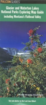
Image for Glacier and Waterton Lakes National Parks Exploring Map Guide

Glacier and Waterton Lakes National Parks Exploring Map Guide : National Parks and the Flathead Valley Exploring Map Guide

Part of the A falcon guide series
See all formats and editions

Glacier and Waterton Lakes National Parks Exploring Map is a full-color, topographic map of Glacier and Waterton Lakes National Parks, layered with information on hiking, biking, camping, fishing, birding, backcountry travel, and more.

What will set this apart from its competitors is its descriptive information on trails, flora and fauna, and points of interest, useful for those interested in exploring the national park.

Read More
Title Unavailable: Out of Print
Product Details
The Lyons Press
076274345X / 9780762743452
Sheet map, folded
01/07/2007
United States
2 pages, full colour illustrations
101 x 229 mm, 3 grams
General (US: Trade) Learn More