Image for Mark Twain, Adventures of Huckleberry Finn Map

Mark Twain, Adventures of Huckleberry Finn Map

Part of the Literary Maps Series series
See all formats and editions

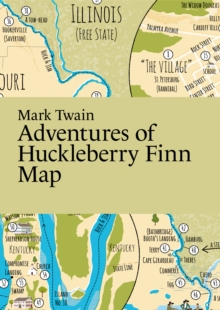
Join Huckleberry Finn and Jim on their journey downstream along the powerful Mississippi River!

This map features stunning illustrations and marks the majority of the locations referenced in Mark Twain's beloved novel from 1884.

Additionally, it also indicates which states permitted or prohibited slavery during the time of the story's occurrence. ?Contains an illustrated map, not the full text. A3-format, folded to A6-format. Printed on recycled paper.

Read More
Special order line: only available to educational & business accounts. Sign In
£6.74 Save 25.00%
RRP £8.99
Product Details
Paris Grafik
9152770966 / 9789152770962
Sheet map, folded
10/04/2024
Sweden
2 pages, 2-sided colour map
105 x 148 mm, 17 grams