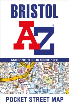
Image for Bristol A-Z Pocket Street Map

Bristol A-Z Pocket Street Map

See all formats and editions

Navigate your way around Bristol with detailed street maps from A-Z This up-to-date, folded A-Z street map includes all of the 1,500 streets in and around Bristol.

Detailed coverage of an area extending from Bishopston in the north to Knowle Golf Course in the south, and from Crew’s Hole in the east to Leigh Woods in the west. The large scale 1 mile to 5.5 inch (1 km to 8.68 cm) street map includes the following: Places of interestOne-way streets and car parksIndex to streets, places of interest, place and area names, park and ride sites, national rail stations, hospitals and hospices The perfect reference map for finding your way around Bristol.

Read More
Available
£3.19 Save 20.00%
RRP £3.99
Add Line Customisation
1 in stock Need More ?
Add to List
Product Details
HarperCollins
0008560471 / 9780008560478
Sheet map, folded
16/03/2023
United Kingdom
2 pages, Index
90 x 140 mm, 40 grams