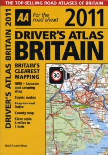
Image for AA Driver's Atlas Britain

AA Driver's Atlas Britain

AA Publishing(Created by)
See all formats and editions

This handy, flexibound glovebox sized road atlas, combines large-scale mapping (4 miles to 1 inch) with an easy-to-carry A5 format.

Each page has been titled with its geographical location so you can turn to the page you need more easily.

Static speed camera locations with speed limits are pinpointed on the mapping.

There is also a full-colour, admin map showing all the latest unitary authority areas, easy-to-use mileage chart and clear easy-to-read index with more then 23,000 place names including airports, top tourist sites and motorway services listed.

Wide minor roads, National Trust, English and World Heritage sites, crematorium locations and other hard-to-find places are also shown.

The paper in this atlas is produced from environmentally sustainable resources.

Read More
Title Unavailable: Out of Print
Product Details
Automobile Association
0749566175 / 9780749566173
Paperback
912.41
01/07/2010
United Kingdom
English
1 atlas (328 p.) : chiefly col. maps
21 cm
General (US: Trade) Learn More