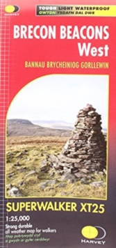
Image for Brecon Beacons West

Brecon Beacons West

Part of the SUPERWALKER XT25 series
See all formats and editions

New, Superwalker XT25 of the Brecon Beacons National Park on 2 sheets.

Brecon Beacons WEST - This map covers Pen y Fan, Fforest Fawr and, the Black Mountain in the far west.

Brecon Beacons National Park boasts a magnificent array of Old Red Sandstone peaks, open moorland and green valleys covering 500 square miles (1344 Square km) of beautiful mid-Wales countryside.

Revised and re-designed they have got everything. Genuine original HARVEY mapping at 1:25,000. Ideal for walking. Clear, easy to read. Easy to re-fold, Opens directly to either side of the sheet.

Slim and flexible. Light to carry. Tearproof, durable, AND - 100% waterproof as standard.

Read More
Special order line: only available to educational & business accounts. Sign In
£12.40 Save 20.00%
RRP £15.50
Product Details
Harvey Map Services Ltd
1851375724 / 9781851375721
Sheet map, folded
26/02/2016
United Kingdom
1 pages
116 x 243 mm, 62 grams