Image for Cornwall Visitors Map

Cornwall Visitors Map (11 Revised edition)

Part of the A-Z Visitors Map series
See all formats and editions

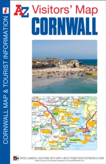
This full colour fold-out Visitors' Map of Cornwall covers the whole county and an area extending into Devon as far as Great Torrington, Tavistock and Plymouth. The detailed road mapping, shown at a clear 2.5 miles to 1 inch scale (1.6 kms to 1 cm), includes primary route destinations, selected safety camera locations, selected caravan and camping sites and visitor attractions and places of interest. There are town centre street maps of:*Bodmin*Bude*Falmouth*Fowey*Launceston*Liskeard*Looe*Newquay*Padstow*Penzance*Plymouth*St.

Ives*Truro Each town centre map is accompanied by descriptive text and helpful information about its visitor attractions and places of interest. There is additional information about Bodmin Moor, Land's End Peninsula, Lizard Peninsula and the Isles of Scilly, which includes an inset map. The index comprises of two sections: the first is an index of cities, towns, villages, hamlets and locations; the second is an index to places of interest and includes a corresponding map symbol alongside each entry for easy identification. This Visitors' Map of Cornwall is ideal for anyone wishing to explore the many attractions this beautiful part of the country has to offer.

Read More
Special order line: only available to educational & business accounts. Sign In
£5.95
Product Details
Geographers' A-Z Map Co Ltd
1843489546 / 9781843489542
Sheet map, folded
18/09/2017
United Kingdom
1 pages
General (US: Trade) Learn More