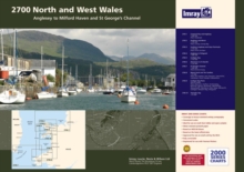
Image for Imray Chart Pack 2700 : North and West Wales

Imray Chart Pack 2700 : North and West Wales

See all formats and editions

A pack of 10 charts covering the North and West coasts of Wales.

In A2 format suitable for small chart tables and compatible with Yeoman plotters.

The pack includes: 2700.1 Liverpool Bay and Anglesey 1:280,000 2700.2 Anglesey and Menai 1:145,000 2700.3 Southern Anglesey and Lleyn Peninsula 1:145,000 2700.4 Anglesey to Fishguard 1:280,000 2700.5 Cardigan Bay 1:145,000 2700.6 Aberaeron to St David's 1:155,000 2700.7 St George's Channel 1:280,000 2700.8 Menai Strait and The Swellies 1:70,000 2700.9 Cardigan Bay Plans (Fishguard, Aberdovey, Newport Bay, Mocras Lagoon, Aberaeron, Aberporth, New Quay, Aversoch, Pwllheli, Aberystwyth, Barmouth, Porthmadog) 2700.10 Tremadoc Bay 1:80,000

Read More
Title Unavailable: Out of Print

The title has been replaced.To check if this specific edition is still available please contact Customer Care +44(0)1482 384660 or schools.services@brownsbfs.co.uk, otherwise please click 9781846237980 to take you to the new version.

This title has been replaced View Replacement
Product Details
1846232597 / 9781846232596
Sheet map, flat
17/12/2009
United Kingdom
10 pages
840 x 596 mm
General (US: Trade) Learn More