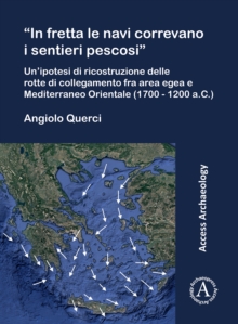
Image for "In fretta le navi correvano i sentieri pescosi"  : un'ipotesi di ricostruzione delle rotte di collegamento fra area egea e Mediterraneo Orientale (1700-1200 a.C.)

"In fretta le navi correvano i sentieri pescosi" : un'ipotesi di ricostruzione delle rotte di collegamento fra area egea e Mediterraneo Orientale (1700-1200 a.C.)

Part of the Access archaeology series
See all formats and editions

From MM III until the end of the LH/LM period, the entire Aegean area was an integral part of a network of trade contacts that included all the major socio-political realities that lined the shores of the eastern Mediterranean basin.

While the archaeological evidence unequivocally attests to the reality of these contacts, it is not so easy to define how they took place, i.e. with which vessels and along which routes they materialised.

The aim of this research is to try to answer this question.

Although not abundant, the available evidence seems to authorise the reconstruction of light-displacement vessels, certainly suitable for sailing on a slack course and probably not suited to tacking the wind beyond a traverse.

The available data also seem to make it more than likely that navigation was characterised by a decidedly seasonal nature.

In view of the supposed characteristics of the boats available, it seems equally likely that the prevalence of synoptic flows from the northern quadrants favoured all sailing in a southerly direction, while at the same time making ascent very problematic.

If, therefore, direct connections between the Aegean area and the southernmost shores of the eastern Mediterranean do not seem to present any particular problems, the ascent routes must have been characterised by cabotage along the Egyptian, Levantine and Anatolian coasts, taking advantage of the thermal breezes that generally blow with non-negligible intensity during the navigation season.

Read More
Available
£38.25 Save 15.00%
RRP £45.00
Add Line Customisation
4 in stock Need More ?
Add to List
Product Details
Archaeopress
1803276460 / 9781803276465
Paperback / softback
23/11/2023
United Kingdom
Italian
vi, 261 pages : maps (colour)
28 cm
Open access version available.