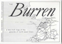
Image for The Burren : A Two Inch Map of the Uplands of North-west Clare

The Burren : A Two Inch Map of the Uplands of North-west Clare (2 Revised edition)

See all formats and editions

This map shows the scarped limestone topography, National Park, roads and paths, caves and potholes, inset maps of Ballyvaughan, Kilfenora and Lisdoonvarna.

The comprehensive archaeological coverage includes 450 cashels, ringforts and similar enclosures, 74 megalithic tombs, numerous early churches, and tower houses.

The cover includes an introductory essay. This updates the 1977 1.8 inch map, showing many recent discoveries, new developments and farm roads.

Read More
Available
£12.99
Add Line Customisation
Usually dispatched within 2 weeks
Add to List
Product Details
Folding Landscapes
0953050912 / 9780953050918
Sheet map, folded
01/07/1999
Ireland
English
General (US: Trade) Learn More