Image for Pustertaler Radweg

Pustertaler Radweg

See all formats and editions

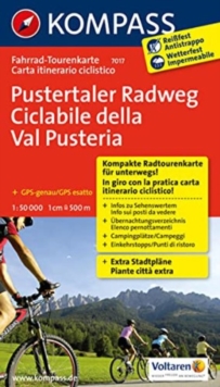
The KOMPASS cycling map series convinces by its: - clear cartography at a scale of 1: 50.000 - detailed information on road conditions, traffic load and gradient conditions - tips on bike-friendly pubs and restaurants, train stations etc ... - handy format, fold once – fits in the bike map holder - tear and weatherproof paper ideal for all weather conditions The tear and weatherproof KOMPASS bike maps on a scale of 1: 50,000 provide a clear cartography.

Detailed route information and tourist information help you to plan your route.

With the new KOMPASS bike maps you are on steady the road!

The new, sophisticated - and reduced to the essentials - cartography provides the cyclist with exactly the information that is important to him.

At an ideal scale of 1: 50,000, the map remains easy to read - and makes orientation fast and easy. - Auf einer Streckenlänge von 105 km führt der Pustertaler Radweg durch das gleichnamige Tal in Südtirol - und zwar von Mühlbach bis nach Lienz in Osttirol. - Der Radweg gilt als besonders familientauglich - die Strecke weist wenig Steigungen auf, verläuft auf ruhigen Nebenstraßen, asphaltierten Rad- und Feldwegen und ist mit vielen Rastplätzen ausgestattet.Entlang der Rienz geht es durch malerische Ortschaften wie Bruneck, Olang oder Innichen.

Zahlreiche Nebenrouten führen zu idyllischen Zielen wie etwa Sand in Taufers oder ins Antholzertal.

Im letzten Abschnitt Richtung Lienz überquert man die italienisch-österreichische Grenze und folgt der Drau bis ans Ziel.

Read More
Special order line: only available to educational & business accounts. Sign In
£5.59 Save 20.00%
RRP £6.99
Product Details
Kompass
3850267849 / 9783850267847
Sheet map, folded
01/05/2013
11 x 18 mm, 103 grams