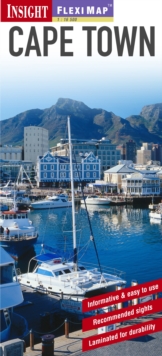
Image for Insight Guides Flexi Map Cape Town

Insight Guides Flexi Map Cape Town (3 Revised edition)

Part of the Insight Guides Flexi Maps series
See all formats and editions

Fleximap Cape Town includes 5 maps. The main map is a detailed street map (1:17 000) including all the major tourists areas, with points of interest and general tourist information clearly marked and indexed by category - streets, shopping, public buildings, parks and hotels. A larger scale map (1:165 000) gives a handy overview of the Cape Peninsula and includes an inset map of Robben Island, there is also a map of Cape Town Environs (1:2 000 000), these maps are indexed for points of interest, streets and places. The back cover is dedicated to the Metrorail network. In addition to the mapping, Fleximap Cape Town also includes a list - with descriptions and some photographs - of 31 recommended sights, divided by theme and linked to the mapping by numbered markers. There is also a handy information section with concise details on getting around the city, tourist offices, money, tipping, opening times, public holidays, telecommunications, emergency telephone numbers and climate.

Read More
Title Unavailable: Out of Print

The title has been replaced.To check if this specific edition is still available please contact Customer Care +44(0)1482 384660 or schools.services@brownsbfs.co.uk, otherwise please click 9781786719416 to take you to the new version.

This title has been replaced View Replacement
Product Details
Insight Guides
1780054165 / 9781780054162
Sheet map
03/09/2012
United Kingdom
1 pages